|
|

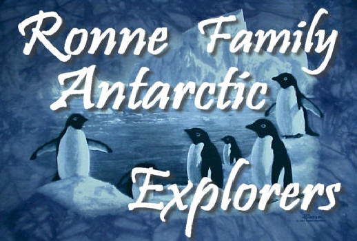
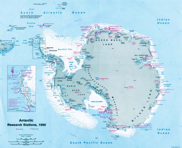
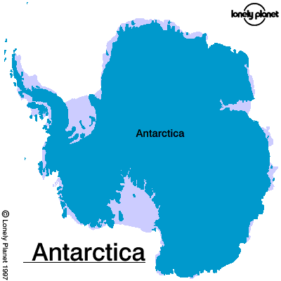
About Stonington
Island
The
Preservation of East Base
Oleona Base: First
Official U.S. Post Office in Antarctica
EAST BASE - THEN AND NOW
Narration of a Slide Lecture
Edith M. "Jackie" Ronne
On the Second Byrd Expedition in
1934, Richard Black and Finn Ronne conceived the idea for additional
American exploration in the Antarctic as they rested on top of Mt. Nielson
on their return from a long sledge trip. Later, through the intervention
of Alaska's Governor Gruening with President Roosevelt, these small plans
snowballed into the United States Antarctic Service Expedition of
1939-41. A half million dollars was appropriated by Congress to explore
new territory and do scientific research at two bases.
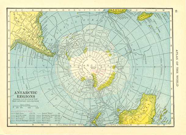
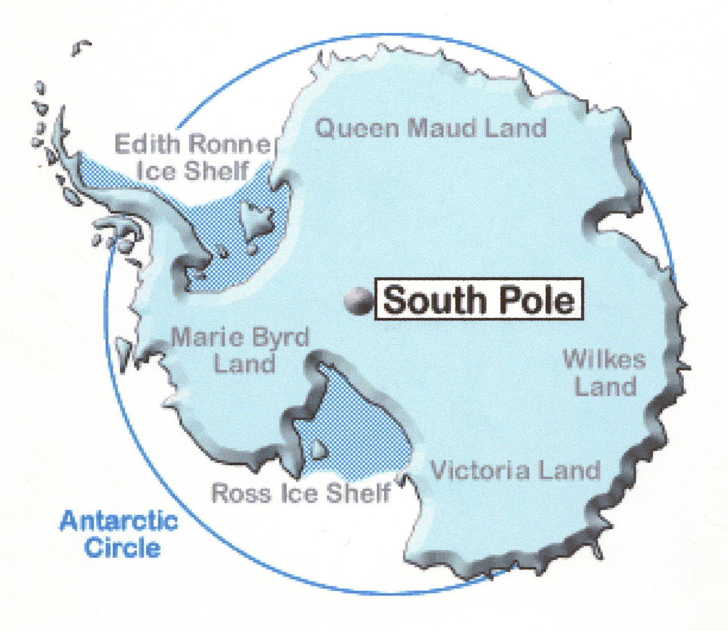
From a map dating to the late 1930’s,
it was clear that there was much geographical information missing in the
Peninsula area. With the southern tip of South America to the right and
the Antarctic Peninsula left of it near the center, there are only dotted
lines hinting at unknown coastlines and features.
West Base was set up near the former
Little America site on the Ross Ice Shelf in east Antarctica with Paul
Siple in charge. East Base was established on Stonington Island in West
Antarctica in March 1940 with Dick Black in charge. Although Admiral
Richard Byrd had been named Commanding Officer, he did not remain in the
Antarctic during their year of operation but instead returned to his home
in Boston. Both bases were under the administration of the Department of
the Interior.
Aerial flights helped them in finding
a suitable location. It ended up on a rocky island (in the middle of the
photo – part of the ice ramp) named Stonington, after Stonington,
Connecticut, the hometown of Nathanial Palmer who discovered Palmer
Peninsula. It was located near mountainous Neny Island in Marguarite Bay.
This island was chosen because a
snowy ramp led up to the long sloping glacier giving the necessary access
to the six thousand foot high plateau dividing the Antarctic Peninsula
north and south to the mainland.
All prefabricated building walls were
carried down on the decks of the North Star.
Finn Ronne was named Second in
Command and was the engineer in charge of setting up the prefabricated
double wooden paneled well insulated buildings with doors resembling the
commercial refrigerator type.
It was an early use of prefabricated
construction and it tested inovative building methods and materials. The
base consisted of a large bunkhouse, with five two man cubicles set
against the outer wall on either side, a good size galley with coal
burning range at the end of the building and two long mess tables placed
end to end occupying the center aisle. There was also a science building
complete with meteorological tower, on the right, here; a machine shop; a
storage shed; and various other outpost buildings.
During the winter night the
twenty-six men made plans and preparations for exploratory plane flights
south in their Curtis-Wright Condor biplane and for surveying sledge
parties by dog teams into the unknown. When the weather and surface
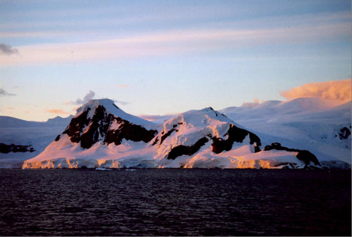
conditions were good, it was wonderfully exhilarating to be out in the
field enjoying the magnificent scenery, but very often a grueling job and
under blizzard conditions there was nothing more miserable and monotonous.
One party headed south in the Weddell
Sea area, while Finn Ronne of Norwegian background and his very good
friend Carl Eklund of Swedish descent, headed southwest to make one of the
longest, fastest and most successful dog team trips on record. With the
support of two additional dog team parties on the first part of their
journey to establish food caches for their return, they traveled 1,264
miles in 84 days of surveying.
Sun sights were taken twice daily in
order to get an astronomical fix and establish their accurate position.
They proved what Sir Hubert Wilkins had suspected, that King George Sixth
Land was instead an island off the Mainland which thus eliminated any
possibility that the Russian Expedition under Von Bellingshausen had first
sighted the continent there in 1821.
At their furthest south location,
they built a cairn and placed claim sheets in the snowy tower. It was
believed that in the touchy area of claiming, if necessary, these claims
would establish U.S. sovereignty over this area.
Exploratory flights were also
conducted from the Main Base west to King George Sound and as far south as
Mount Tricorn and Cape Eielson near the Weddell Sea Coast.
In addition a scientific program was
conducted at the Main Base. By now the barkentine Bear, which was
assigned to pick up East Base personnel, made more urgent by the ongoing
war in Europe, had managed to break through the ice pack as far as
Mikkelsen Island, where solid ice surrounding Stonington Island made it
impossible to relieve the men as planned.
East Base was finally evacuated by
two very hazardous plane flights, allowing the 26 men to take only their
scientific records and a few personal items. As I recall, 98% of USAS
personnel joined the armed Services in World War II. Their work was
published in the Proceedings of the American Philosophical Society
publication in April 1945.
As World War II drew to a close, Finn
once again began making plans for his own expedition. After great
dedication and unbelievable persistence he became only the third and last
American ever to launch a private scientific expedition to the Antarctic.
The Port of Beaumont was what we
named a former ocean going tug, which was obtained on loan from the Navy
by an act of Congress. The 183 foot long wooden hulled ship was named for
our port of departure, Beaumont, Texas. Some financing came from
donations and a small contract with the Office of Naval Research for the
scientific results. Through the great interest of General Curtis LeMay of
the Air Force three small planes, one of which was equipped with
trimetrogon cameras, two weasels, and considerable amount of clothing was
acquired for testing under cold climatic conditions. A contract with the
North American Newspaper Alliance for news reports and some private funds,
mainly from friends, rounded out a minimum sum necessary for departure.
For the most part members of the expedition were volunteers.
Having assisted him in editorial
work, I was very familiar with all of his plans. It had been my intention
to handle the domestic side of the expedition from our home in Washington,
D.C. where I was employed by the Department of State and had taken a
two-week leave of absence to see him off.
Because of some last minute
unforeseen delays, Finn asked me to continue as far as Panama to catch up
with some final problems. I asked Jennie Darlington, who was recently
married to Harry, one of our pilots, and still on her honeymoon to
accompany me. We could fly back from Panama together I reasoned. As usual
I took over Finn's writing duties and before long he began to insist that
I would be of more help to him by going the entire way. This I resisted
strongly for many good reasons until the very last minute in Valparaiso,
Chile when I finally gave in. He agreed that Jennie could go with me.
The approach to the Continent through
light pack ice was magnificent. I was totally in awe of where I was going
and I anticipated a great adventure. We anchored outside a small British
Base, one of several established secretly on the Antarctic Peninsula
during the war years. When I stepped ashore with Finn, it was brought to
my attention that I was the first American woman to set foot on the
continent. I honestly had not even considered that.
The occasion was that I accompanied
Finn ashore to call on the British Leader, K.S. Pierce-Butler, who
diplomatically pointed out to us that we were on British claimed
territory. Finn replied that we were merely an American expedition
reoccupying an American-built base. After that political do-si-do, we
became great pals.
Ken Butler accompanied us over the
small hill separating the two camps to show us what had taken place. He
told Finn that within the last couple of days a Chilean ship had been in
and their personnel had been given unlimited shore leave. Unfortunately,
he was unable to control their actions at the American Base and there had
been a great deal of looting taking place. Just six years after the USAS
had evacuated East Base, it was in unbelievably disastrous condition.
After inspecting the Base, Finn had
our ship brought around into the back bay near the base so that our men
could see their new home for the next year. They started unloading the
ship and moving supplies to shore using makeshift rafts. After several
weeks of intensive fix-up, the camp was put in livable order and all hands
were able to move ashore.
The dogs were the first ashore. I
developed a good relationship with the puppy born on the way down. He was
named Kasco, after a sponsoring dog food company. Finn did not
train the dogs for this expedition as he had for the last two expeditions
he was on. He maintained a friendlier relationship with these
dogs.
Before the winternight, a trail party
established a weather station on 6,000-foot high plateau. Ignoring Finn’s
safety guidelines, the two men returning from the plateau removed their
skis in a highly crevassed area.
One man broke through an ice bridge
and fell over 120 feet head first. Finn organized a rescue party, but
with the man stuck head down in a crevasse for 12 hours, Finn expected to
find a body. Instead, with ropes they plucked him from his would-be tomb
like a tooth from a socket; with only minor injuries, the man lived to
tell the tale .
The ship was purposely frozen-in for
the long winter months in the back bay between Stonington Island and the
mainland. It was not long before the sun began to disappear on the
northern horizon and the winternight was upon us for two and a half months
of darkness. During this period intensive plans were made for the summer
field programs.
Finn and I stayed in our 12 foot
square hut, connected to the main bunkhouse by a canvas hallway that soon
became a buried snow tunnel. I wrote newspaper releases for the North
American Newspaper Alliance and the New York Times, while Finn plotted
plane flights and dog team routes for the sledge parties to follow in the
field when the sun returned.
Necessary activities in the course of
the day became a real challenge, causing you to think twice as to whether
you really wanted to make the trip there. In storms, there was a rope
tied between the main bunkhouse and the outhouse, and during blizzards you
sometimes had to hold on for dear life.
Trail gear was assembled by those
going on sledge trips. From the radio shack, we sent twice daily weather
reports to the weather bureau in Washington, as well as seismological data
from our two seismographs receiving information on Antarctic earthquakes
and microseisms for the first time. In the blubber shack dog food was
made by rendering seal blubber down to seal oil and mixed with commercial
dog food.
Parachutes were checked and placed in
the planes for each person flying. We checked out the weasels and
classes were given in navigation and safety on the trail.
On moon lit nights we skied on the
ramp leading to the high glacier overlooking our base. Well,
sometimes, we skied!
During the winternight, much drifting
snow accumulated against the buildings, burying them until Spring.
As soon as the sun returned the dogs were exercised and dog team parties
assembled. Geologist Dr. Robert L. Nichols and his assistant Bob Dodson
started off with their two dog teams on what turned out to be a 154 day
sledge trip, 54 days of which were spent completely on geological field
work, more than any geologist up to that time.
The trimetrogon equipped Beechcraft,
our largest plane, was kept on board the ship until the bay ice was strong
enough to hold its being pulled ashore by the tractor weasel. As soon as
its wings were assembled They were ready to fly. This is a view of the
planes as they were parked right adjacent to our buildings. The
Beechcraft took off on our strong bay ice runway for numerous exploratory
flights
We used the leap frog methods on the
longest ones. Our main geographical objective was to capture the last
unknown coastline in the world, that 500 mile stretch from Palmer Land to
Coats Land, which established the fact there could be no frozen strait
dividing the continent between the Ross and Weddell seas at that point.
There was even open water at the head
of the Weddell Sea. On the second long exploratory flight, they followed
the Mountainous Palmer Land Plateau to where it dies out in higher land
continuing south.
Every available flying day was spent
doing exploratory trimetrogon flights. Camera mounted in the fuselage of
the plane were focused on each horizon and straight down, taking
simultaneous photographs with 60% overlap. Altogether, they flew 39,000
miles in 346 hours in the air, almost twice as much as any expedition thus
far. 86 landings were made in the field, more than half of which were
unsupported. 14,000 aerial photographs were obtained supported by ground
control points obtained by surface parties, so that accurate maps could
be made over this part of the Antarctic by the aeronautical chart service
of the Air Force. The red lines show the flight tracks and the entire
area inside the bubble lines was mapped. 250,000 square miles of
new territory, or the size of Texas was discovered and the very first
landing ever was made on Charcot Island.
Prior to leaving on the expedition,
Finn had been secretly sworn-in as a 4th class U.S. Post Master
and he established the first U.S. post office in Antarctica, naming it
Oleona Base. I took this photo of a quick display of the sign, as he and
I were the only ones who knew of its existence. He cancelled opening date
and closing date covers that were later given to the State Department and
the Post Office Department for assisting in possible future land claims.
The Antarctic Treaty of 1959 – 61 holds all national claims in abeyance.
Meanwhile, at Base, shown here from
the glacier, investigations continued in climatology, terrestrial
magnetism, seismology, geology, and other branches of science. Of course,
the study of penguins is always a popular branch of science. Fourteen
scientific reports were published by the Office of Naval Research upon our
return.
All of our plans had been carried out
very successfully. It was time to go - our flag was lowered, our ship
reloaded and led to open water by a visiting American icebreaker. Our
thoughts turned northward wondering if we would ever see Antarctica
again. Some of us did.
Waving enthusiastically to crowds who
gathered, we were glad to sail by the Statue of Liberty as we were
greeted by a celebratory water spray. Upon our arrival in New York, we
were well received by the American Geographical Society.
Back at East Base, after RARE left,
subsequent expeditions of various nationalities removed everything from
the interior of the buildings. The British dismantled the Machine shop
and probably used the wood to put in the second floor in the Main
Bunkhouse that covered ice accumulated from a broken skylight and used the
higher space to store dead seals for dogfood. They used the Science
building for sled repair and rope storage. Interior walls were removed -
only a short section remains.
In 1989 East Base was designated a
historic monument under the Antarctic Treaty. The National Science
Foundation has assumed preservation of the buildings, artifacts and
surroundings as an important reminder of the early days of American
exploration of the continent. In early 1991, two National Park Service
archeologists were sent down to assess the material remains of
archeological and historical value at East Base.
Another visit was made to East Base
by the National Science Foundation in 1992 to clean up potentially
hazardous materials and unsightly trash areas. They also made necessary
repairs, patching open walls and roofs. They installed protective and
educational signs.
In 1995, my daughter and I made an
unexpected visit to the Base on the tourist ship "Explorer". Although not
publicized as such, their priority seems to have been to get me ashore at
East Base after an absence of nearly forty-eight years.
Although I had since returned to
Antarctica twice, including a trip directly to the South Pole in 1971, I
never thought it would be possible to return to this uniquely special site
and certainly not with my daughter, Karen, to be able to share it with
her.
By piling two large rocks on top of
one another, we were able to peer into the Ronne Hut, as it was now
labeled, and saw the empty room used by the British in the 1950s for an
emergency generator on concrete pad in the center of the floor. Gone
were the numerous shelves for personal belongs, the tables holding my
typewriter and Finn’s desk, our double bunk, the small coal burning stove
which kept us warm, curtains on the two windows Finn had made to give us
views of the surrounding grandeur, and the canvass wall coverings that
provided interior decoration. Now, it was bare and barren.
The same was true of the large
bunkhouse - there was nothing left of the bunks, tables, chairs, galley
stove and kitchen equipment - nothing, nothing, except frozen snow in the
rear which the NSF personnel had chipped away, but not completely
removed. The Science building faired a bit better exhibiting a small wire
caged museum containing bits and pieces of crockery and other very small
things picked up around the buildings to show visitors these buildings had
once housed two good sized American expeditions bent on exploration and
scientific research.
My daughter, an architect, had made
three large plaques covered with heavy plastic, which we screwed tightly
into the wall. One gave the history and accomplishments of the Ronne
Expedition, another gave Finn’s biography and the third was about my
participation in the expedition and my life, to date.
After taking some photographs and a
last look, we returned to the ship in silence. I was grateful to have
seen East Base once again, and I hope many more travelers will experience
a visit to the remnants of the oldest remaining U.S. presence in
Antarctica.
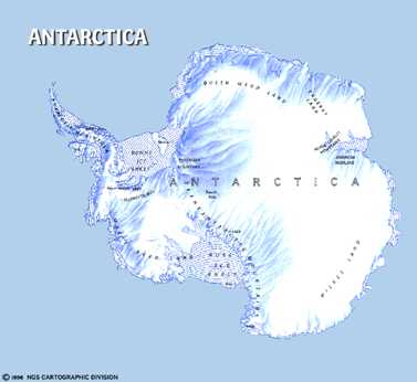
About Stonington Island:
55 Buildings and artefacts on Stonington Island, Marguerite
Bay, Antarctic Peninsula. 68°11'S, 67°00'W. Buildings and
artefacts at and near East Base of the US Antarctic Service
Expedition, 1940-41, and the Ronne Antarctic Research Expedition,
1947-48.
East Base, Stonington Island (68° 11'S67° 00'W). Buildings and
artifacts and their immediate environs. These structures were erected
and used during two U.S. wintering expeditions: the Antarctic Service
Expedition (1939-1941) and the Ronne Antarctic Research Expedition
(1947-1948).The historic area is 1000 meters in the north-south
direction (from the beach to Northeast Glacier adjacent to Back Bay)
and 500 meters in the east-west direction.
The size of the historic area is approximately 1,000 meters in the north-south direction
(from the beach to Northeast Glacier adjacent to
Back Bay) and approximately 500 metres in the
Reclaiming a Lost Antarctic Base. By Michael Parfit, Photographs
by Robb Kendrick. In National Geographic Vol 183, No 3, pp
110-126, March 1993. A survey and restoration team visits "...historic
East Base, the United States' first permanent toehold in Antarctica,
surrendered to the cold in 1948." East Base was established in 1940 on
Stonington Island, Marguerite Bay, Antarctic Peninsula. It was here
where the first two women winter-overed: Edith "Jackie" Ronne and
Jennie Darlington.
The Ronne Antarctic Research Expedition (1947-48),
led by Finn Ronne, was the last privately sponsored U.S. expedition.
Using Byrd's old base on Stonington Island, Ronne closed the
unexplored gap at the head of the Weddell Sea.
The first woman to set foot on the continent was Caroline Mikkelsen
from Norway. She landed at Vestfold Hills on February 20, 1935, with
her husband who was a whaler. The first women to winter in Antarctica
were Edith Ronne and Jennie Darlington in 1947. They spent a year with
their husbands on Stonington Island in the Antarctic Peninsula region
during the Ronne Antarctic Research Expedition (American naval
commander Finn Ronne led this expedition which discovered the Ronne
Ice Shelf at the southern coast of the Weddell Sea). The first women
to see the South Pole were two stewardesses aboard a commercial flight
that flew over the Pole as it traveled from Christchurch to McMurdo in
1957.
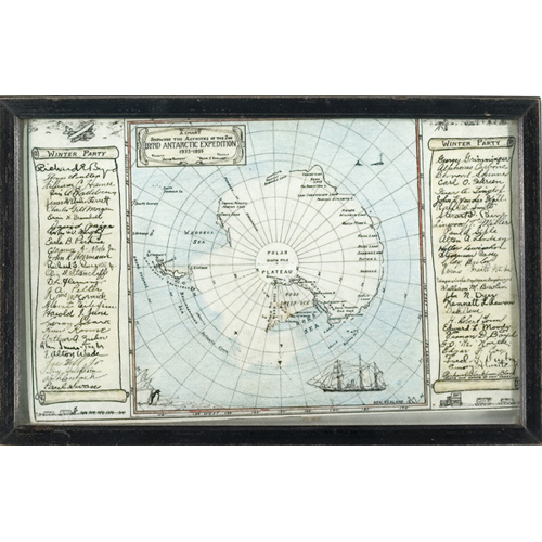
Captain Finn Ronne, USNR/Military Commander Scientific
Leader/Ellsworth Station, Edith Ronne Land/Antarctica".
Norwegian-born Finn Ronne came to America in 1923 when he was 24. He
was with Byrd in Antarctica (1933-1935, 1939-1941) and led
his own Antarctic expeditions in 1946-1948, 1958-1959 and
1962-1969. Ronne was the Commander of the Weddell Sea Station
during the International Geophysical Year (1956-1958). The Ronne Ice
Shelf is named in his honor.
CRM at East Base, Antarctica
The ice-breaker slowed to the pace of a row boat as it crunched
through the brackish ice of
the LeMaire Straits. Disturbed crab eater seals looked briefly toward
the big red boat, then slid
away into the sea. Penguins, startled in disbelief at the intruder,
dove off their ice blocks. We
were bound for Stonington Island, site of America's and Antarctica's
most recently designated
historic monument. Captain Alex of Erebus ensured our safe arrival on
February 21, 1991,
the final destination of a journey that began six months earlier with
a phone call.
Much of the environmental community is disturbed about the untidy
nature of the
continent, and the National Science Foundation, concerned as well, had
initiated measures to
clean up former research stations.
While planning their effort, they recognized the historic significance
of "East Base,
Stonington Island," site of an early winter-over expedition. Further
research and conferences
changed the NSF mission from clean-up to one of sympathetic
preservation of the site while
ensuring that hazardous materials were removed. After a 1990 field
check, they found that
East Base, the oldest remaining U.S. base in the Antarctic, had a host
of artifacts. That is
when they called the National Park Service for technical advice. In
February, we boarded a
boat bound for Antarctica.
East Base was established as part of Admiral Byrd's third expedition
to the Antarctic
(1939-1941). Known officially as the U.S. Antarctic Service Expedition
(USASE), the full
scale exploration of the continent was supported by President
Roosevelt. Admiral Byrd
established two bases, West Base at Little America III and East Base
on Stonington Island.
The base was a cluster of U.S. Army, knock-down buildings built by a
crew of 23 under
Richard Black. The men used a Curtiss-Wright Condor airplane and dog
sleds to survey the
peninsula. In 1941, as wartime pressure increased and the pack-ice in
the bay prevented a
planned departure by ship, Black decided to hurriedly evacuate the
base by air. Crates of food,
a spare plane engine, a tank and tractor and much gear were left
behind. In 1947-1948, the
privately funded Ronne Antarctic Research Expedition (RARE)
re-occupied East Base. Finn
Ronne, Richard Black's second in command, led RARE and conducted more
explorations.
The RARE expedition was also significant for being the first site
where women (Edith
"Jackie" Ronne and Jennie Darlingon) wintered-over in the Antarctic.
When we arrived, on a calm, sunny (55 degrees) uncommon Antarctic day,
the
completeness of the site amazed us. Buildings and material culture
were in surprisingly good
shape. Pothunters and bottle collectors would have destroyed a similar
50-year-old site in the
United States. Trash dumps contained material in incredible condition-a
1939 Reader's
Digest in which one could read about sex education in public schools,
a shirt from Ike
Musselman, one of the USASE crew, bottles from the doctor's office, a
spare 1930s Curtiss-
Wright plane engine, hay piles, and three of the buildings. Everything
had a history, a history
pieced together by published books, records at the National Archives
and interviews. Mrs.
Jackie Ronne drew us a layout of her hut on a napkin at a MacDonald's
restaurant in
Washington, DC before we left. It helped piece together on-the-ground
evidence: stacks of
trail mixings, caches of coal for stoves, and on and on.
Our report, a description of resources and recommendations for
management, will be used
by the National Science Foundation to manage the site and, in the
immediate future, remove
any hazardous material: a corbel of acid from the science lab,
sulfuric acid from the doctor's
office and other dangers. The team will repair and make air-tight the
buildings, unfortunately
much altered on the interiors by a nearby British base. The former
bunk house was used as a
seal-slaughter house and is befouled with the waste. Preservation
crews will patch the
building and lock it shut. Its fate is uncertain. The valuable
artifacts in the trash dumps will not
be salvaged at this time. At present a light covering of gravel from
the island will serve as a
cap to ensure their preservation, allowing future archeologists to
excavate the site based on our
field mapping and photographs, as well as improve the present
unsightly appearance of the
As the preservation and clean-up effort is underway, the National
Science Foundation will
prepare interpretive signs to ensure that the East Base Historic
Monument is not impacted by
increased visitation. The site, as a listed Antarctic national
monument, may become a
destination point for the few tourist boats that venture south along
the scenic Antarctic
Peninsula. The number of visitors to the site are few, but during our
journey we met
Australian, French and British tourists, the former while we were at
East Base.
As the movement for a world park on Antarctica continues to be
discussed and introduced
in Congress, we need to continue to stress the importance of people in
the Antarctic story. The
East Base site is but one piece of the whole century and a half of
exploration and discovery.
The site deserves preservation. Cultural resource management will
continue to be an important
part of the management of Antarctica.
Cathy Spude is an archeologist with the Western Team at the Denver
Service Center,
National Park Service. Robert Spude is chief, National Preservation
Programs Branch, Rocky
Mountain Region, National Park Service.
Wilderness of ice felt like a visit to
another planet
ANTARCTICA - When I was a
young boy, one of my parent's closest friends was Finn Ronne, one of the
world's great polar explorers. During those years, Finn often came to our
house for dinner and talked at length about his latest adventures to
Antarctica, which he affectionately described as "the last unspoiled place
on Earth."
By
dog sled, ski and ship, Finn covered more of Antarctica than any other
explorer. For hours on end, my brother and I sat at the dinner table,
mesmerized by his tales.
As
I grew older, I often recalled Finn's exploits and hoped that one day I
might also have an opportunity to visit Antarctica. But while the notion
of travelling to "the last continent" seemed pretty remote a few decades
ago, much has changed as the number of organized tours to this remote part
of the world has increased dramatically.
After reading about one such trip being organized by Australian-based
Peregrine Adventures that also coincided with the 60th anniversary of
Finn's most famous expedition, I finally decided to go.
Our
journey would commence from Ushuaia, Argentina, located on the southern
tip of South America. A city with a stunning mountainous backdrop and a
population of 45,000, Ushuaia proudly promotes itself as being at the end
of the world ("fin del mundo" in Spanish) and is often cited as the
southernmost city on the planet. It was here that I joined the other
passengers who had signed up for our expedition.
After taking a day to explore the town as well as nearby Tierra del Fuego
National Park, we finally boarded the Akademik Ioffe, a relatively small
and manoeuvrable expedition ship that would be our home for the next 11
days. Late that afternoon, we set sail into the Beagle Channel and began
our journey to the Antarctic Peninsula.
But
first, we would have to cross the 1,000-km Drake Passage, a notoriously
violent stretch of water that separates Antarctica from the rest of the
world and, for the next two days, the passage lived up to its reputation.
The seas were big and the conditions were rough, but tolerable (thanks
largely to the Gravol we were all encouraged to bring).
During our time at sea, I read as much as I could about Antarctica. By any
measure, it's a land of extremes, being the coldest, driest and windiest
continent on Earth. To the surprise of many, it's also the highest, with
an average elevation of 2,300 metres, much of that ice.
Late on the second day of our journey, I took a walk on deck and could
feel and see a sudden change; the air was cooler and fresher, there were
several visible icebergs and a growing number of birds were circling the
boat.
We
were approaching the Peninsula!
Within hours, I saw the South Shetland Islands, our first glimpse of land.
I felt the adrenaline rush through me and, throughout the ship, there was
a sense of excitement and anticipation. We had made it and were now ready
to embark on an unforgettable journey to the most remote place on Earth.
For
the next several days, we cruised among the islands and into the bays of
the Antarctic Peninsula. On the ship, we also had a fleet of kayaks and
motorized Zodiac rafts that would enable us to explore seldom seen places
while also venturing ashore for numerous walks and hikes. And whatever
one's expectations are of such a trip, I soon realized that nothing quite
prepares you for the amazing landscapes and wildlife displays that are
found here.
We
visited many incredible places, including Deception Island, an ancient
volcanic caldera from which Nathaniel Palmer, a seal trader and explorer,
first spotted the Antarctic mainland back in 1820. The island is home to
more than 100,000 pairs of chinstrap penguins as well as a century-old
abandoned whaling station that was fascinating to explore.
Our
first foray on to the continent itself was at the beautifully situated
Neko Harbour. After landing by raft, we hiked up a steep icy trail to the
top of a hill where we enjoyed some breath-taking panoramic views of the
rugged coastline and interior mountains before deciding to slide back down
to the bottom (laughing like kids as we went!).
To
the surprise of many, the weather was downright balmy by Antarctic
standards, although it cooled quickly whenever the wind came up. We were
there right in the midst of the brief, but beautiful, austral summer and
the temperature hovered close to zero degrees Celsius for much of our
trip. By contrast, winter temperatures on the continent have been recorded
as low as minus 89 degrees Celsius.
On
Cuverville Island, we came across a large colony of nesting gentoo
penguins and, after seeing how docile and accepting they were in our
presence, I appreciated the efforts of our able and energetic expedition
leader, Hayley Shephard, in ensuring that no passenger approached the
birds too closely.
On
other days, we took our rafts through a maze of icebergs, many of which
were a dazzling blue, due to the way sunlight is reflected by the ancient
high-density ice. On these same outings, we had some amazing close-up
encounters with humpback whales as well as leopard and crabeater seals.
On
one of these occasions, two whales emerged right beside our raft, their
mouths wide open as they gorged on a swarm of krill we had drifted
through. Close enough to touch, the whales slowly sank back into the
depths of the sea, our rafts bouncing in their wake. It was a magical
moment and all of us sat there in awe.
Later in the trip, we also had a very informative visit to the Vernadsky
Research Station, currently operated by the Ukrainian government. This
facility has accumulated more than 50 years of meteorological data, which
has been invaluable to scientists working on issues such as climate change
and atmospheric ozone levels.
During our tour of the station, I asked about the anticipated impacts that
might be associated with global warming. We were told that, while it
appears that Antarctica has not yet been affected to the same degree as
the Arctic, researchers have documented a warming trend of 1 to 1.5
degrees Celsius per decade in the western Antarctic, a region of lower
elevations and more moderate temperatures compared to the eastern part of
the continent. Consequently, the glaciers and ice sheets along the western
edge of Antarctica appear to be the most vulnerable if global warming
continues unabated.
Each passing day seemed to bring something new and, while we had so many
memorable experiences, perhaps the highlight of the trip was the night
that I camped ashore. Our trip was one of the few that actually allows
passengers the option of camping -- so I jumped at the chance.
That evening in my bivy sack (a small one-person tent), I felt like I was
finally alone with the spectacular solitude of Antarctica, although it was
never really silent. The rifle-like sound of cracking glaciers, an
occasional gusty wind and the mournful braying of nearby penguins
continued through the night. Yet, it was a wonderful sound and, more so
than ever, I understood the great allure of this far corner of the planet.
Early next morning, our raft picked us up and we headed back to the ship
for breakfast. We would soon be leaving, heading back across the passage
toward Cape Horn and then on to Ushuaia.
I
started to reflect on the past several days and I felt so fortunate to
have seen a place of such incredible beauty. The trip had been a
once-in-a-lifetime experience and there is simply nowhere else on Earth
that is so removed from the day-to-day lives that most of us lead.
I
then recalled those long-ago dinner conversations with Finn Ronne when he
tried to describe to a young boy what Antarctica was like. He used terms
such as "otherworldly" and "like being on another planet" while more
recent adventurers, such as Jon Krakauer, have likened a trip to
Antarctica as a bit like going to the moon.
Now
that I've seen this crystalline wilderness, I think that's a pretty apt
description. And while I may never witness the beauty of a distant planet
or star, I knew this trip was as close as I would ever come.
We
then entered the rough seas of the Drake Passage and started the long
journey home.
-------------------------------------------
Mark Angelo is
the head of the BCIT Fish and Wildlife Department and recently received a
special United Nations Stewardship award for his international
conservation and education work.
IF
YOU GO ...
The
best (and only) time to visit Antarctica is from December to March. The
best departure point is Ushuaia, located at the southern tip of Argentina
and about a four-hour flight from Buenos Aires.
No
visa is required for Canadian visitors to Argentina. While a range of
Antarctic tours and ship sizes are available, boats of moderate size with
a fleet of Zodiacs make it possible to access a greater number of islands
and bays. Mid-sized ships also enable passengers to hop ashore more
quickly. For more information on Antarctica expeditions, contact Mountain
Travel Sobek at 1-888-687-6235 (www.mtsobek.com), Peregrine Adventures (www.peregrineadventures.com)
or Trek Escapes in Vancouver at 604-734-1066.
Oleona Base: First Official
U.S. Post Office in Antarctica
A Secret
U.S. Post Office operated in Antarctica
1946-1948
causing speculation
about the real reason behind two concurrent U.S. expeditions...
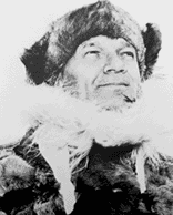
Finn Ronne
Finn
Ronne was a Norwegian immigrant who later joined the United States
Navy and was a member and officer in Admiral Byrd's earlier
expeditions to Antarctica. In 1946-8, he led a privately-financed
expedition to Antarctica, following upon the heels of Operation Highjump.
Ronne's expedition was to the Marguerite Bay area, where he reoccupied
Byrd's 1939 Base. One of the most important results of this expedition
was a showing that the Antarctic peninsula was connected to the rest of
Antarctica, thus solving one of the last great public mysteries of the
continent.
Writing in his book
entitled "Antarctic Conquest", he stated:
"Although no one knew
it, I had been operating a United States Post office too, but
for reasons of state
(emphasis added) had been
compelled to keep it secret."
Secrecy seems to be in no
scarcity as it relates to several Antarctic expeditions; perhaps in no
small way due to a continued concern that the Nazis had a remnant left
in Antarctica from their infamous 1938-9 "New Schwabenland" colonization
of Antarctica. Note carefully the Swastika in the following photo of
aircraft aboard the Schwabenland, the vessel that took them south.
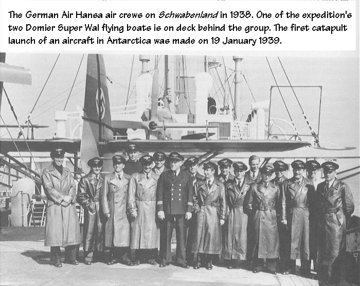
(Photo source unknown, and is
presumed to be in the public domain)
The web is abundant with sites setting forth information about suspected
and actual German involvement in Antarctica possibly dating back even to
the late 1800's. It does make one wonder if there were in fact,
covert or as they say today, "black-ops" reasons for one or more of the
Byrd Expeditions (including Operation Highjump for this discussion) as
well as the private expedition of Captain Ronne.
Many online sources are available with information concerning what I
have dubbed the "Byrd Conspiracy", which was not a conspiracy by
Admiral Byrd, rather what may have been an apparent conspiracy by the
government to keep particular information that he had uncovered during
Operation Highjump as a secret. I am not passing judgment at this time,
as I am still investigating the whole thing to my satisfaction.
However, lending credence to this conspiracy theory is the observation
that Admiral Byrd does in effect seem to "disappear" from public view
shortly after his return from Operation Highjump in 1947-- until
approximately 1955 when he organized Operation Deep Freeze I, and he
was reported to have been hospitalized (in a mental ward) shortly after
his return in 1947. This forced hospitalization is said to have came
upon the tails of Byrd having made some remarkably candid comments
(which included what smacked of being a description of a UFO) to
a South American newspaper about what he had found during Operation
Highjump. His disappearance from the scene after his arrival back in
the states, would make it appear he may have been promptly
squelched! Remember that this time period coincided roughly with the
Roswell UFO sightings. Operation Highjump would have been first, early
in 1947, and then Roswell to follow in the summer of 1947. This was a
situation that was the last thing the government would have wanted,
another military official (in this case a quite prominent and popular
man who had spent years criss-crossing the United States giving lectures
and whose word would have been quite respected and accepted) who
apparently reported having seen/and or believing in UFOs!!
NOTE: If Op HJ had continued to its full expected duration of
six to eight months, they would have still been in Antarctica at the
time of Roswell. The expedition headed back to the U.S. in early 1947,
well short of its expected ending. Some would say "limped back", after
suffering great losses of personnel and equipment. The official record
only sets forth a limited loss of life and aircraft, but conspiracists
feel the record has been doctored or we are not being told the full
story.
Contrast this lack of
public accessibility after Operation Highjump, to the
previous well-known availability of Admiral Byrd in the period following
his first two Antarctic Expeditions, where there are documented
philatelic items from cities all over the country serving as
commemorations of where Byrd visited lecturing to the public about his
travels in Antarctica. That Byrd loved to travel and lecture about his
polar explorations is quite evident.
The polar regions and his
expeditions were his very reason for existence; he had said from the
time he was a child that he felt destined to be a polar explorer. He
had a passion for all things polar, especially exploration, that could
scarcely be contained. Operation Highjump was at least
as important in many respects, it would appear, as his previous
expeditions... so where was he after his return? Where did he go? Was
he locked away so he couldn't share the story of what he really had
found in Antarctica? As some theorists suggest, during Operation
Highjump, did he encounter and engage Nazi forces operating from bases
that lodged advanced aircraft with advanced propulsion systems?
Many think so, and I am beginning to see some curiosities about many
aspects of Operation Highjump and now, perhaps even with Ronne's
Expedition.
The little tidbit mentioned above that
Ronne forked us in his book, only begins to tell us why the
Oleana Base, Antarctica postmark is one of the rarest polar cancels that
exist. With this being the first American post office established on
the Antarctic continent, it is a shame that the cancel was not used more
often. Is there perhaps a larger reason why this post office was kept
secret? We do know that many countries, including Britain, had
concurrent secret bases and or expeditions in the same general time
period, notably Port Lockroy on the Antarctic peninsula. Port Lockroy
was part of a top secret World War II British expedition called
Operation Tabarin.
Operation Tabarin was the beginning of Britain's permanent
presence on the Antarctic continent, and was built to serve as a
southern outpost and to keep an eye on suspected Nazi presence on the
ice. In a 2001 BBC interview, one of the last remaining survivors of
that secret expedition, Gwion Davies, noted that the posting of mail
from their secret base was a way of their laying claim to, or
establishing that section of Antarctica as British sovereign territory.
In other words, just as the Nazis are known to have dropped metal dart/
markers with the Third Reich swastika emblem over a large area of
Antarctica during their expedition in 1939, to act as a laying of a
claim; for any country (such as Britain) to have a post office that
actually accepted and postmarked mail definitely shows an intention on
their part of not only establishing a base, but of staying.
While the United States did not then, and does not now, recognize any
country as having specific territorial claims upon Antarctica, for Ronne
to have allowed his expedition members to have open mailing of letters
from Oleana Base would have served a similar purpose as with Port
Lockroy, but for some reason, he would not allow that to be done. Why?
Some mail did escape, and other mail from members of the Ronne
Expedition is known to have been posted from nearby British bases. The
posting of mail often serves a geo-political purpose in addition to the
simple fact it carries mail back home to loved ones; and it is a great
curiosity to many polar philatelists and followers of Antarctic history
that it was not done in this instance. The full story about the
existence of the post office (as well as even greater secrets?) may have
passed with Captain Ronne.
The "Holy Grail" of
Antarctic Covers
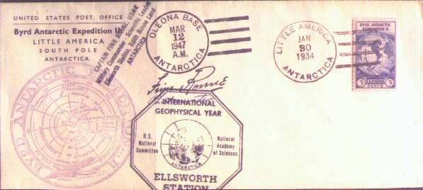
Click on the above image
for a larger view; copy of cover was provided courtesy of Scott Smith
The Oleana Bay
covers are most commonly seen with a date of March 12, 1947, which was
the date the expedition arrived at Marguerite Bay, Antarctica. In this
instance, the cover illustrated above is extraordinary in that it is on
a printed envelope from the Byrd II Antarctic Expedition,
postmarked with the less common hand cancellation from that mission;
then repostmarked at Oleana Base in 1947, with the addition of Captain
Ronne's "corner card" and the IGY Ellsworth Station octagonal cachet,
and the best part of all, Ronne's signature in which he adds the word
"Postmaster", rounding it out to make a splendid cover! A cover like
this would fare extremely well in a polar auction. I would go so far
to term it as the "Holy Grail" of a polar collection; only very
few covers I can think of would be more collectable, in my opinion.
Credit for the
content to KGØYH's Polar
Philately Page
The URL for this page is
http://www.qsl.net/kg0yh/oleana.htm
Permission
granted to use material through August 10, 2019.
Permission ID
QSL2009-02.
|